The Cotswolds, an Area of Outstanding Natural Beauty (AONB) stretching across five English counties, present a unique structural challenge for the independent visitor. Unlike the dense, walkable urban centers of London or Edinburgh, this region is a 787-square-mile tapestry of limestone villages, ancient wolds, and fragmented public infrastructure. For the individual traveler, the experience is defined by the tension between aesthetic tranquility and the logistical rigor required to navigate a landscape primarily designed for local agricultural life and private vehicular access.
To engage with this region effectively, one must move beyond the curated imagery of honey-colored stone and thatched roofs. True mastery of the landscape requires a clinical understanding of “Hub-and-Spoke” logistics, the seasonal ebb and flow of tourist density, and the historical socioeconomic forces that shaped these settlements. In the contemporary travel landscape, the Cotswolds serve as a case study in “Slow Travel” principles, where the lack of a centralized rapid-transit system acts as a natural filter, rewarding the patient and the prepared while frustrating those accustomed to high-velocity metropolitan movement.
This editorial pillar interrogates the specific mechanics of navigating the region without a group or a dedicated driver. By deconstructing the geographic “Zones of Accessibility” and applying mental models of resource allocation, we can establish a rigorous framework for an independent journey. The objective is to provide a definitive reference that addresses the practicalities of isolation, the nuances of rural safety, and the optimization of a solitary itinerary within one of England’s most protected and scrutinized environments.
Cotswolds solo travel.
s.yimg.com
At its core, Cotswolds solo travel is an exercise in “Logistical Self-Sufficiency.” In a region where a missed bus connection can result in a four-hour wait in a village with no cellular reception, the solitary traveler must operate with a higher degree of redundancy than they would in a standard European capital.
Multi-Perspective Explanation
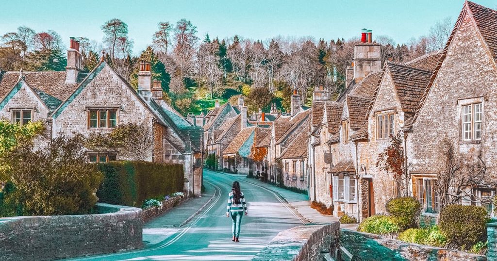
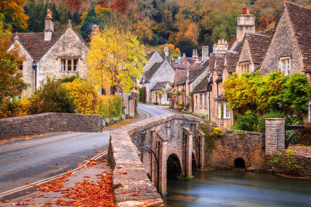
From a Geographical Perspective, the region is not a monolith. It is a series of undulating hills (the “Wolds”) punctuated by steep escarpments and river valleys. For a solo traveler, the topography dictates the mode of transport. The northern Cotswolds, centered around Chipping Campden and Broadway, offer more dramatic heights and rigorous hiking trails, whereas the south, near Castle Combe and Lacock, presents a more compact, valley-focused architecture.
From a Social Perspective, the region can be paradoxically lonely and intrusive. While the villages are world-famous, the inhabitants are often private, and the “Pub Culture” can be difficult to penetrate as a lone diner during peak Sunday roast hours. Understanding the social etiquette of the English country pub, where to sit, how to order at the bar, and the subtle cues of communal space, is essential for the solitary visitor’s comfort.
From a Safety Perspective, the risks are rarely criminal; they are environmental. The primary hazards involve “Public Footpath” navigation, where mud, livestock, and rapidly changing weather patterns can disorient the uninitiated. A solo traveler lacks the “Second Pair of Eyes” necessary to confirm a faded wooden stile marker or a turn in a dense thicket of trees.
Contextual Background: Wool Wealth and AONB Designation
The aesthetic of the Cotswolds is the direct result of medieval economic dominance. During the 13th to 15th centuries, the “Cotswold Lion” sheep produced the finest wool in Europe. The wealth generated from this trade was poured into the construction of “Wool Churches” and grand manor houses built from the local oolitic limestone. This creates the visual consistency we see today, but for the solo traveler, it also explains the settlement patterns: compact villages clustered around a church and a manor, separated by vast stretches of former grazing land.
In 1966, the region was designated an Area of Outstanding Natural Beauty. This legal status is critical for the visitor to understand because it restricts modern development. For the traveler, this means that while the scenery remains pristine, the infrastructureroads, parking, and telecommunications towersis often decades behind the needs of modern tourism. The solo visitor is essentially stepping into a landscape that is legally mandated to resist the very modernization that would make their travel easier.
Conceptual Frameworks and Mental Models
1. The “Strategic Anchor” Model
This framework posits that a solo traveler should spend 70% of their research identifying a single town with a railway station and a reliable supermarket. This “Anchor” (e.g., Cheltenham, Moreton-in-Marsh, or Stroud) serves as the logistical base. All excursions into the “Deep Cotswolds” are treated as spokes from this hub, ensuring that the traveler always returns to a place with lighting, dining options, and connectivity.
2. The “Footpath-First” Heuristic
To truly experience the region, one must prioritize the “Public Right of Way” over the road. However, for a solo traveler, this requires the “Rule of Three”: always have a digital map (OS Maps), a physical backup, and a compass. This mental model emphasizes that the most authentic villages are often inaccessible by car and require a 2–3 mile walk through private farmland, which is legally accessible to the public but functionally hidden.
3. The “Cotswold Time-Tax.”
This model calculates the actual cost of movement. If a map says a walk will take one hour, the solo traveler must add a 30% “Time-Tax” for navigating gates, interacting with livestock, and checking directions. On public transit, the tax is 100% one must assume that any bus trip will take twice as long as the timetable suggests due to narrow lanes and seasonal traffic.
Key Categories of Cotswolds Micro-Regions
| Region | Primary Characteristic | Solitary Utility | Trade-off |
| Northern Fringe | High Wolds, Chipping Campden. | Best for serious hikers. | Isolated; few rail links. |
| Railway Corridor | Moreton-in-Marsh, Charlbury. | Highest accessibility. | Higher tourist density. |
| River Valleys | Bourton-on-the-Water, Bibury. | Aesthetic peak. | Extreme crowding; parking issues. |
| Southern Edge | Castle Combe, Bath, proximity. | Quiet, historic depth. | Difficult without a car. |
| Stroud Valleys | Industrial history, steep hills. | Authentic, less “curated.” | Steeper terrain. |
| Market Towns | Cirencester, Tetbury. | Practical services, antiques. | Less “village” feel. |
Detailed Real-World Scenarios and Decision Logic
The Car-Free Dilemma
A traveler arrives at Moreton-in-Marsh station with the intent to see Snowshill and Broadway.
-
The Logic: Relying on the 801 bus is a “High-Risk” move on a Saturday.
-
The Decision: Pre-book a local taxi for a specific drop-off at Snowshill Manor and a pick-up three hours later in Broadway.
-
Failure Mode: Assuming a taxi will be “available” at the station without a booking. Rural taxi firms often operate with very few vehicles.
The “Peak Season” Buffer
A solo traveler wants to visit Bibury (Arlington Row) in July.
-
The Logic: Arriving at 11:00 AM will result in a “Crowd-Saturated” experience that negates the solitary benefit.
-
The Action: Stay in Cirencester, take the earliest bus (or a bike), and arrive by 8:30 AM.
-
Outcome: The traveler has 90 minutes of relative silence before the tour buses arrive from London, allowing for a higher “Reflective Dividend.”
Planning, Cost, and Resource Dynamics
The “Cost” of Cotswolds solo travel is often inversely proportional to the traveler’s patience. A car-free journey is cheaper in currency but significantly more expensive in “Logistical Labor.”
Resource Allocation Table
| Expense Category | Budget Range (Daily) | Variability Factors | Opportunity Cost |
| Accommodation | £80 – £250 | Proximity to “Anchor” towns. | Remote B&Bs cost more in taxis. |
| Transport (Rail/Bus) | £10 – £30 | Use of “Rover” passes. | High time cost/waiting. |
| Transport (Car Hire) | £50 – £120 | Fuel, parking, insurance. | Loss of “Slow Travel” nuance. |
| Dining | £30 – £70 | Pub vs. Tea Room vs. Supermarket. | Pubs require early booking. |
Risk Landscape and Taxonomy of Failure Modes
-
The “Last Bus” Fallacy: Assuming the last bus will arrive. In rural England, mechanical failures or driver shortages can result in a “Ghost Service.” Always have the numbers of three local taxi firms saved in your phone.
-
The “Livestock Buffer”: Entering a field with cows, particularly with calves. For a solo traveler, there is no one to assist if a herd becomes aggressive. The rule is simple: walk wide, do not run, and ensure the gate is closed.
-
The “Monday/Tuesday Closure”: Many independent shops and pubs in smaller villages (like Stanton or Upper Slaughter) close on Mondays and Tuesdays. Planning a visit on these days can result in a “Service Desert.”
Common Misconceptions and Oversimplifications
-
“It’s always quaint”: False. The Cotswolds are a working agricultural region. Expect tractors, mud, and farm noise.
-
“Public transport is impossible”: False. It is difficult and requires research, but using Moreton-in-Marsh as a hub makes it entirely possible.
-
“Castle Combe is the best village”: Oversimplified. While beautiful, it is a “Museum Village.” Winchcombe or Painswick offer a more authentic balance of local life.
-
“I need a car to see the ‘real’ Cotswolds”: The opposite is often true. Drivers spend their time looking for parking, while walkers see the hidden valleys and ancient bridleways inaccessible to vehicles.
Conclusion
Successfully executing Cotswolds solo travel is a testament to an individual’s logistical foresight and emotional maturity. It is a region that does not offer itself up easily to the hurried or the disorganized. Instead, it requires a deliberate slowing down, an acceptance of rural rhythm, and a commitment to the “Rigors of the Path.” By utilizing the strategic anchor model and respecting the environmental constraints of the AONB, the solo traveler can transform a potentially lonely excursion into a profound encounter with English history and landscape.