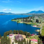

dirganews.com – The highland region surrounding Abha presents a layered and often misunderstood landscape geographically, culturally, and experientially. Located within the Asir mountain range in southwestern Saudi Arabia, this area sits at the intersection of altitude-driven climate changes, historical settlement patterns, and a growing but uneven infrastructure for outdoor exploration. As a result, what is often seen as simple scenic tourism is actually a far more complex environment shaped by competing forces such as preservation and development, accessibility and isolation, as well as tradition and modern leisure.
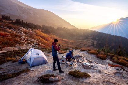
To better understand an Adventure Abha Highlands experience, it is important to look beyond basic descriptions like cool weather and mountain views. In fact, the terrain is highly complex, consisting of steep escarpments, wide plateaus, deep valleys, and constantly changing ecological zones. Moreover, human interaction with this landscape, whether through farming, settlements, or tourism, has developed unevenly over time. Consequently, this has created a mix of easily accessible areas and remote regions that are difficult to standardize.
Overall, this article approaches the Abha highlands as a dynamic system rather than just a travel destination. Specifically, it explores the key elements that shape an Adventure Abha Highlands experience from environmental conditions and mental frameworks to logistical considerations and long-term sustainability. At the same time, it maintains a practical focus grounded in real-world conditions and limitations.
Understanding “Adventure Abha Highlands”
www.gradiant.com
The phrase Adventure Abha Highlands often simplifies a wide range of experiences into a single concept. As a result, this simplification can create several misunderstandings. For example, it may suggest that all areas offer the same experience, even though the region is highly varied. In addition, it can give the impression that everything is easily accessible, while in reality, many areas still involve logistical challenges.
At its core, the concept refers to exploring the mountainous regions around Abha in a more active and immersive way, rather than just observing the scenery. However, this type of engagement can take different forms. For instance:
- Structured recreation, such as guided hikes, aerial activities, or designated viewpoints
- Semi-structured exploration, including marked trails with limited facilities
- Unstructured immersion, such as off-grid navigation or exploring remote valleys
Each of these approaches operates under different conditions. Therefore, they require different levels of preparation, awareness, and skill.
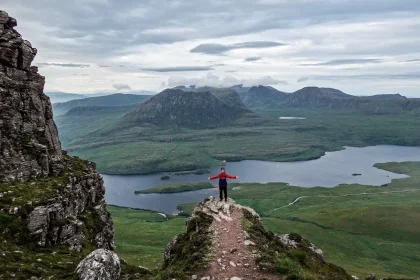
Furthermore, people often assume that more scenic locations automatically provide a better experience. However, this is not always the case. For example, a viewpoint that can be reached by car may offer impressive visuals but limited interaction with the environment. On the other hand, a long descent into a valley may not appear as visually dramatic at first, yet it often provides a deeper and more meaningful connection with the landscape.
Overall, understanding these differences helps create more realistic expectations and allows for better planning when approaching an Adventure Abha Highlands experience.
Deep Contextual Background
The Abha highlands have developed over time through a combination of geological processes, climate variation, and human adaptation. In particular, the Asir Mountains were formed through tectonic uplift, which created steep slopes that directly influence local weather patterns. As moist air from the Red Sea moves inland, it rises along these slopes and cools, leading to localized rainfall. Because of this process, the region supports vegetation that is quite rare in other parts of the Arabian Peninsula.
Historically, people adapted to this challenging environment through terrace farming. In order to make the steep land usable, communities invested significant effort into reshaping the terrain. As a result, these terraces are still visible today. More importantly, they are not just historical features; rather, they show how people successfully adapted to difficult geographic conditions over time.
In more recent years, modern development has introduced roads, communication networks, and tourism infrastructure. However, this growth has not been evenly distributed. On the one hand, some areas are now easily accessible and well-developed. On the other hand, nearby regions remain remote and difficult to reach. Consequently, this has created a two-layered system: one part designed for visitors, and another that still maintains a strong sense of isolation.
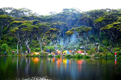
At the same time, the rise of organized outdoor activities reflects a broader shift toward experience-based tourism. Activities such as hiking and exploration are becoming more common. Nevertheless, this development has not fully balanced the need for accessibility with the importance of preservation. For instance, increased foot traffic, off-road vehicle use, and ongoing construction continue to place pressure on the environment. Therefore, these factors add new challenges to an already complex and evolving landscape.
Conceptual Frameworks and Mental Models
1. Accessibility vs. Authenticity Trade-Off
Greater accessibility often reduces logistical barriers but can dilute the sense of immersion. Remote areas preserve authenticity but demand higher preparation and tolerance for uncertainty.
Limit: This model can oversimplify, as some accessible areas still offer meaningful engagement depending on timing and conditions.
2. Terrain Complexity Gradient
Terrain can be viewed along a gradient from stable (paved viewpoints) to dynamic (rocky descents, shifting trails). Movement along this gradient requires incremental skill adaptation.
Limit: Environmental conditions, ns such as weather, can shift terrain classification rapidly.
3. Risk Accumulation Model
Risk does not emerge from a single factor but accumulates through interactions—fatigue, navigation errors, and weather changes.
Limit: Difficult to quantify in real time; relies on judgment rather than precise measurement.
4. Experience Depth Model
Experience depth increases with time, effort, and engagement, but may plateau if conditions become repetitive or overly constrained.
Limit: Highly subjective; varies between individuals.
5. Resource Elasticity Framework
Resources (time, energy, equipment) are not fixed; they stretch or contract based on conditions. Efficient allocation becomes critical in uncertain environments.
Limit: Assumes flexibility that may not exist in tightly scheduled scenarios.
Key Categories and Variations
| Category | Characteristics | Advantages | Constraints |
|---|---|---|---|
| Scenic Access Routes | Road-based viewpoints | Low effort, high visual return | Limited immersion |
| Marked Trails | Defined paths | Moderate engagement, safer navigation | Predictable, sometimes crowded |
| Semi-Remote Valleys | Partial infrastructure | Balanced experience | Requires planning |
| Remote Highland Zones | Minimal access | High authenticity | High risk, limited support |
| Aerial Activities | Paragliding, viewpoints | Unique perspective | Weather-dependent |
| Off-Road Exploration | Vehicle-based | Broad coverage | Environmental impact |
| Cultural Landscape Integration | Villages, terraces | Contextual richness | Less physical challenge |
Decision Logic
- Limited time → Scenic access or marked trails
- Moderate experience → Semi-remote valleys
- High experience and preparation → Remote zones
- Interest in perspective → Aerial activities
- Mixed objectives → Combine categories sequentially
Real-World Scenarios and Decision Points
www.timeoutriyadh.com
Limited-Time Exploration
Constraint: 1–2 days, minimal preparation
Decision: Focus on accessible viewpoints and short trails
Failure Mode: Overpacking schedule, reducing depth
Second-Order Effect: Perception of superficial experience
Moderate Experience with Flexible Schedule
Constraint: 3–5 days
Decision: Combine marked trails with semi-remote exploration
Failure Mode: Underestimating the transition time between areas
Second-Order Effect: Resource depletion (energy, daylight)
High-Experience Remote Exploration
Constraint: Limited support infrastructure
Decision: Prioritize navigation accuracy and contingency planning
Failure Mode: Misjudging terrain difficulty
Second-Order Effect: Compounded risk due to isolation
Weather-Variable Conditions
Constraint: Unpredictable climate
Decision: Maintain adaptable itinerary
Failure Mode: Rigid planning
Second-Order Effect: Increased exposure to unsafe conditions
Planning, Cost, and Resource Dynamics
| Cost Category | Low Range | Mid Range | High Range |
|---|---|---|---|
| Transportation | Local travel | Rental vehicle | Specialized off-road |
| Accommodation | Basic lodging | Mid-tier hotels | Premium stays |
| Equipment | Minimal gear | Standard outdoor kit | Advanced gear |
| Activities | Self-guided | Guided tours | Specialized experiences |
Indirect costs include time investment, physical fatigue, and the opportunity cost of limited flexibility.
Tools, Strategies, and Support Systems

iranontour.com
- Offline navigation systems
- Layered clothing for altitude variation
- Energy management strategies
- Local knowledge integration
- Time-buffer planning
- Redundant communication methods
- Terrain-specific footwear
- Structured reflection and adjustment
Each tool has limits; overreliance on any single system introduces vulnerability.
Risk Landscape and Failure Modes
Primary Risk Categories
- Environmental (weather shifts)
- Physical (injury, fatigue)
- Navigational (route errors)
- Resource depletion (water, energy)
Compounding Risks
- Fatigue leading to poor decisions
- Weather shifts are increasing terrain difficulty
- Isolation amplifies minor errors
Governance, Maintenance, and Long-Term Adaptation
Monitoring
- Weather updates
- Energy levels
- Route progress
Review Cycles
- Daily assessment of plan vs. reality
- Mid-journey adjustment points
Adjustment Triggers
- Unexpected terrain difficulty
- Resource depletion thresholds
- Environmental changes
Layered Checklist
- Pre-departure planning
- On-site monitoring
- Post-activity evaluation
Measurement, Tracking, and Evaluation
Leading Indicators
- Energy consistency
- Navigation accuracy
- Time buffer retention
Lagging Indicators
- Completion of planned routes
- Physical recovery
- Overall experience quality
Documentation Examples
- Route logs
- Daily reflection notes
- Resource usage tracking
- Adjustment decisions
Common Misconceptions and Oversimplifications
- “All highland areas are similar.” → Terrain varies significantly
- “Cool weather equals easy conditions” → Weather variability persists
- “Access equals safety” → Risk still exists
- “More activities = better experience” → Depth often decreases
- “Navigation is straightforward.” → Terrain complexity challenges this
- “Short trips require minimal planning.” → Time constraints increase pressure
- “Remote equals better” → Depends on capability and goals
Ethical and Contextual Considerations
Engaging with the Abha highlands comes with important responsibilities. As activity in the area increases, it can put pressure on fragile ecosystems, especially in locations that are not designed to handle large numbers of visitors. For example, off-road exploration may seem attractive at first; however, it can cause long-term environmental damage that is not immediately visible.
In addition, there is a strong cultural aspect to consider. The landscapes in this region are not purely natural; they are closely connected to both historical and modern human life. Therefore, respecting these areas means understanding local traditions, practices, and sensitivities.
Because of this, finding a balance between exploration and preservation becomes essential. On one hand, people want to experience the beauty of the highlands. On the other hand, these environments need protection to remain sustainable. Ultimately, the long-term success of any Adventure Abha Highlands experience depends on maintaining this balance carefully.
Conclusion
The Abha highlands are not easy to define in simple terms. They are neither fully accessible nor completely remote, and they are not entirely natural nor fully shaped by human activity. Because of this complexity, anyone who wants to truly engage with this environment needs to understand its layered nature, geographical, cultural, and logistical.
When approached with proper preparation and awareness, an Adventure Abha Highlands experience offers a unique mix of immersion and complexity. On one hand, it challenges common assumptions about terrain, planning, and personal limits. On the other hand, it creates space for adaptation, learning, and reflection.
In the end, the true value of the experience does not come from simply completing planned activities. Instead, it comes from the ability to navigate a constantly changing environment with clarity and flexibility. Rather than presenting a single fixed experience, the landscape allows for different interpretations, which are shaped by individual decisions, constraints, and changing conditions.