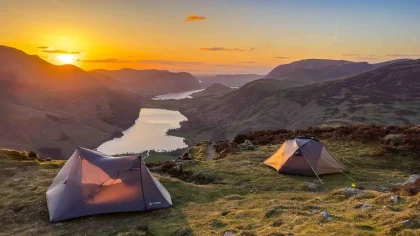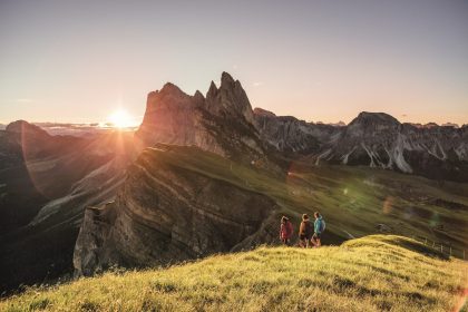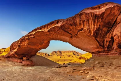
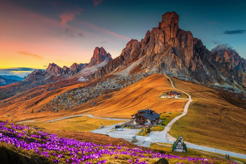
dirganews.com – The Dolomites, a sub-range of the Southern Limestone Alps in northeastern Italy, represent a geological and cultural anomaly that defies the standard tropes of European mountaineering. Characterized by vertical pale-colored peaks, deep glacial valleys, and a high density of rock spires, the region is a UNESCO World Heritage site not merely for its aesthetic drama but for its Earth-science significance. The “Dolomite” rock itself, calcium magnesium carbonate, undergoes a photochemical reaction at sunset known as the enrosadira, where the pale faces transition through hues of burning orange to deep violet. This atmospheric phenomenon serves as a backdrop to a trail network that is perhaps the most sophisticated in the world, blending high-altitude ruggedness with an egalitarian infrastructure.
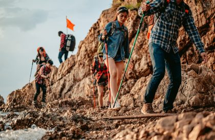
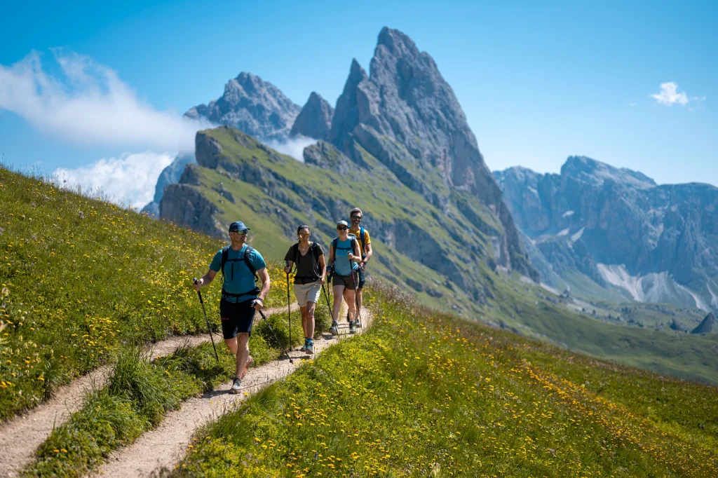
Engaging with this landscape requires an analytical shift away from the “wilderness” concept familiar to North American hikers. In the Dolomites, the mountains are an inhabited space, a palimpsest of Austro-Hungarian military engineering, Ladin cultural identity, and Italian alpine tradition. The journey is rarely a solitary fight against an unmapped void; rather, it is a precise exercise in navigating a complex system of rifugi (mountain huts), vie ferrate (iron paths), and diverse linguistic territories.
As we look toward the 2026 season, the structural realities of the Dolomites are being reshaped by climate variability and the pressures of peak-season saturation. Glacier recession on the Marmolada and the increasing frequency of summer convective storms have altered the risk profile for standard routes. Consequently, a definitive reference for a serious mountain endeavor must move beyond “top ten” lists to address the mechanical and systemic realities of high-altitude travel. This investigation deconstructs the essential components of a high-caliber alpine experience, prioritizing geological literacy, logistical redundancy, and historical context.
Understanding “Hiking Adventure in the Dolomites”
www.dolomitemountains.com
A multi-perspective deconstruction of a Hiking Adventure in the Dolomites reveals a tension between accessibility and technicality. From a geological perspective, the plan is a journey through an ancient coral reef system, thrust upward by the collision of the African and Eurasian plates. From a sociological perspective, it is a study in “High-Altitude Hospitality,” where the rifugio system allows for multi-day traverses without the burden of self-sufficiency. However, the oversimplification of these mountains as “civilized hiking” poses a significant risk to the unprepared.
Common misunderstandings often stem from the “optical illusion” of the Dolomites. Because the vertical faces are so close to the lush pastures and lift systems, hikers frequently underestimate the physiological toll of rapid vertical gain and the radical shifts in microclimates. A path that appears to be a gentle meadow stroll can transition into a technical scree slope or a fixed-cable section within minutes. The adventure is therefore not found in the lack of trails, but in the sophisticated selection of routes that balance aesthetic reward with technical feasibility.
The risk of oversimplification is highest in the “Alta Via” (High Path) narratives. While the Alta Via 1 is often marketed as a beginner’s multi-day trek, it crosses passes exceeding 2,500 meters where snow can persist into July, and lightning strikes are a daily summer hazard. A true understanding of the Dolomites requires viewing the terrain through the lens of “Systemic Complexity,” where physical fitness, gear choice, and meteorological timing must align to produce a successful outcome.
Deep Contextual Background: The Pale Mountains
The systemic evolution of the Dolomites as a hiking destination is inextricably linked to the First World War. Before the 20th century, these peaks were the domain of local shepherds and a few pioneering British and German climbers. The Great War transformed the vertical landscape into a “White War” theater. To sustain troops at high altitudes, the Italian Alpini and Austro-Hungarian Kaiserjäger blasted tunnels through the rock and installed the first vie ferrate fixed steel cables, ladders, and bridges.
Post-war, these military supply lines were repurposed for civilian use. This transition laid the groundwork for the modern trail system (the sentieri). The 1960s and 70s saw the formalization of the Alte Vie long-distance routes that traverse the range from north to south. This era shifted the focus from peak-bagging to the “Transverse Experience,” where the goal was to stay above the tree line for weeks at a time.
Today, the system is undergoing a “Technological Integration.” Digital cartography and real-time mountain rescue tracking have made the peaks more accessible, yet the fundamental geology remains indifferent to these advances. The history of the Dolomites is a cycle of human intervention attempting to “tame” the verticality, only to be reminded of the rock’s fragility through massive landslides and glacial collapses.
Conceptual Frameworks and Mental Models
To navigate the Dolomites effectively, one must employ several mental models that differ from standard forest hiking.
1. The “Vertical Kilometer” Framework
In the Dolomites, horizontal distance is often irrelevant. A 5-mile hike with 1,200 meters of elevation gain is a vastly different physiological event than a 5-mile flat trek. Mental models should focus on Vertical Meters per Hour (VMH). A standard fit hiker gains approximately 300-400 meters per hour. Planning routes by VMH prevents the “Nightfall Trap” where hikers are stranded on technical ridges after the sun sets.
2. The “Refuge Hub-and-Spoke” Model
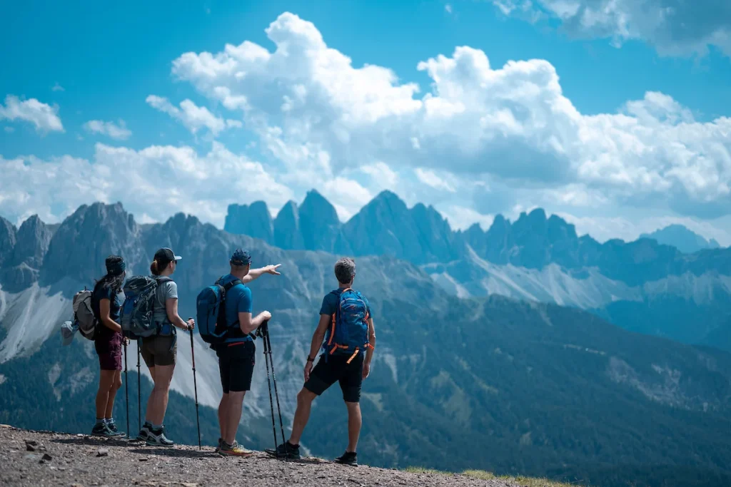
Instead of a linear point-to-point march, the most resilient strategy is often a “Hub-and-Spoke” model. By basing oneself at a high-altitude rifugio for 2-3 days, a hiker can explore multiple technical spurs and peaks with a light pack, returning to a stable base. This minimizes the risk of carrying heavy loads over unstable scree.
3. The “Atmospheric Convergence” Filter
The Dolomites act as a massive barrier between the temperate European plains and the Mediterranean humidity. This creates a “Convective Cycle” where clear mornings almost inevitably lead to afternoon cumulonimbus formations. The mental model here is “Early Start, Early Finish,” aiming to be off the high ridges and at the next hut by 2:00 PM.
Key Categories of Alpine Engagement
The Dolomites offer varied modalities of hiking, each with distinct trade-offs.
| Category | Primary Benefit | Operational Trade-off | Ideal Landscape |
| Alta Via (Multi-Day) | Total immersion; landscape variety. | Requires months-ahead booking; heavy logistical load. | Dolomites of Braies, Civetta. |
| Via Ferrata (Technical) | Access to vertical faces for non-climbers. | High equipment requirement; intense objective risk. | Brenta Group, Sella Massif. |
| Day-Hiking (Lift-Assisted) | High aesthetic reward for low physical cost. | High human density; “Disneyfication” risk. | Seceda, Alpe di Siusi. |
| Ladin Valley Treks | Cultural immersion; lower altitude. | Less dramatic vistas; more road walking. | Val Badia, Val di Fassa. |
| Military History Trails | Deep contextual engagement; tunnels. | Damp, dark environments; requires lighting. | Lagazuoi, Cinque Torri. |
Detailed Real-World Scenarios
The “Marmolada Recession” Constraint
A hiker plans a crossing of the Marmolada glacier in late August.
-
The Constraint: Heatwaves have made the ice unstable, increasing the risk of serac collapse.
-
The Decision: Pivoting to the “Sentiero delle Creste” (Ridge Path), which stays on solid rock but offers similar panoramic views.
-
Failure Mode: Attempting the glacier without crampons or a guide in high-melt conditions.
The “Sella Massif” Saturation
A group arrives at the Passo Pordoi intending to hike to the Piz Boè summit.
-
The Constraint: The cable car has offloaded 500 people in the last hour.
-
The Strategy: Using the “Val Mezdì” descent route—a steep, technical canyon that requires more stamina but sheds 95% of the crowd.
-
Second-Order Effect: Discovery of unique fossils in the canyon floor that are obscured on the main summit trail.
The “Ladin Micro-Climate” Storm
A solo hiker on the Alta Via 2 sees dark clouds forming over the Rosengarten.
-
The Constraint: The next hut is 3 hours away across a technical ridge.
-
The Decision: Utilizing a “Bivacco” (unmanned emergency shelter) mapped earlier.
-
Outcome: Avoiding a lightning strike on the exposed ridge, but sacrificing a warm meal for a night in a metal box.
Planning, Cost, and Resource Dynamics
57hours.com
A Dolomites expedition involves daily transactional costs for food, lodging, and transport. Unlike wilderness trips where costs are front-loaded (gear), the Dolomites are service-intensive.
| Expense Item | Budget (Self-Catering) | Mid-Range (Rifugi/Dorms) | Premium (Private/Hotel) |
| Lodging | €15-30 (Camping/Bivacco) | €60-90 (Half-Board) | €150-250 (Hotels) |
| Transport | €10 (Bus/Trains) | €30 (Lift Passes) | €80 (Private Transfers) |
| Gear Amortization | €20 (Basic kit) | €40 (Technical gear) | €100+ (High-end UL) |
| Food/Sundries | €20 | €40 | €80 |
The “Opportunity Cost” of choosing the peak month of August is a cost in quietude. Planning for a “Shoulder Season” (late June or September) provides a 20-30% cost reduction and a 50% increase in solitude value.
Tools, Strategies, and Support Systems
-
Tabacco Maps (1:25,000): The gold standard. Digital apps often fail to distinguish between a “Path” and a “Climbing Route.”
-
Linguistic Lexicon: Many locations have three names (Ladin, Italian, German). Understanding roots helps in reading trail signage correctly.
-
Telescopic Trekking Poles: Essential for protecting knee cartilage during 1,000-meter descents.
-
Dolomiti Emergency Insurance: Covers helicopter extraction, which can otherwise cost upwards of €5,000.
-
Multi-Layer Clothing: Must account for 20-degree Celsius temperature swings between valleys and summits.
-
Lightweight Ferrata Set: Even if not planning a technical route, it provides an “Anchor of Safety” on exposed sections of the Alta Via.
Risk Landscape and Failure Modes
-
Geological Instability: Limestone is prone to rockfall, particularly after heavy rain. Avoid walking beneath overhanging cliffs during or after a storm.
-
Meteorological Volatility: Lightning is the primary hazard. Underestimating cumulonimbus speed leads to high-altitude exposure.
-
Human Factor: Taking a lift to 3,000m without proper acclimatization or warm gear, then attempting a long descent as the lift closes.
Governance and Long-Term Adaptation
-
Weather Audits: Checking MeteoMont or local provincial stations every 4 hours.
-
Infrastructure Checks: Trail closures are common due to landslides. Review CAI (Club Alpino Italiano) bulletins daily.
-
Biological Adaptation: Monitoring hydration; high calcium content in local water can cause digestive distress in some travelers.
Measurement, Tracking, and Evaluation
-
Leading Indicators: Morning resting heart rate; quality of sleep at altitude; accuracy of predicted arrival times.
-
Lagging Indicators: Total vertical gain achieved over 10 days; lack of overuse injuries; the ratio of peak experiences to logistical stressors.
Common Misconceptions and Oversimplifications
-
“It’s just like the Rockies.” (Correction: The Rockies are older and lack the verticality and hut infrastructure of the Dolomites.)
-
“I don’t need a map because trails are marked.” (Correction: Markers can be buried in snow; a map is a redundant safety system.)
-
“The huts are like hotels.” (Correction: They are mountain shelters. Expect communal dorms and strict lights-out times.)
-
“Streams are safe to drink.” (Correction: High grazing density means most streams are contaminated with livestock waste.)
-
“Via Ferrata is just hiking.” (Correction: It is vertical movement that requires specific fall-arrest gear.)
Conclusion: The Synthesis of Modern Exploration
A Hiking Adventure in the Dolomites is a confrontation with deep time. It is a synthesis of physical exertion, logistical precision, and historical reflection. By moving beyond surface-level beauty and engaging with the mechanical and cultural realities of the range, the hiker transitions from a tourist to an alpine practitioner. The Dolomites do not ask to be conquered; they ask to be understood. Success is measured not by the summit reached, but by the wisdom to know when to descend.