
dirganews.com – Jeju Island, Korea, is not merely a regional resort province; it is a geological anomaly, a linguistic enclave, and a survivor of 20th-century political cataclysms that nearly erased its social fabric. To observe Jeju through the lens of casual tourism is to miss the systemic tension between its UNESCO-protected ecological “museums” and its aggressive pursuit of status as a Free International City.
This island, born of Quaternary volcanic activity that spanned 1.8 million years, sits atop a 100-meter-deep continental shelf. Its identity is forged in “Samdado”, the abundance of three things: wind, stones, and women. A Special Self-Governing Province, Jeju operates with a degree of legislative and administrative autonomy unseen elsewhere in South Korea, managing a delicate equilibrium between 13.8 million annual visitors and the preservation of its fragile lava tube systems.
Understanding this landscape requires moving beyond surface-level aesthetics. It demands an analysis of the “Oreum” (parasitic cones) that pockmark the island like scars, the “4.3 Incident” that dictates modern social memory, and the hydraulic realities of an island that relies almost entirely on groundwater captured by porous volcanic rock. This article serves as a definitive reference for those seeking to grasp the functional and historical architecture of Korea’s only island province.
Understanding “Jeju Island, Korea.”
global.ssl.fastly.net
To define Jeju Island, Korea is to reconcile three distinct identities: the geological, the historical, and the economic. Geologically, it is a “Volcanic Museum” comprising over 360 monogenetic volcanoes (Oreum) and one of the world’s most extensive lava tube systems. Historically, it was the independent Tamna Kingdom, later an exiled territory for Joseon scholars, and eventually a site of state-sponsored trauma. Economically, it is South Korea’s primary testing ground for “Green Growth” and “Free City” experimentation.
A common misunderstanding involves the island’s scale. Despite being only 73 kilometers wide, the central presence of Mount Hallasan (1,950 meters) creates microclimates that can render northern Jeju (Jeju-si) sunny while the south (Seogwipo) is engulfed in heavy fog or rain.
The oversimplification risk lies in treating Jeju as a “monolithic paradise.” In reality, the island is a high-conflict zone for environmental policy. The “Free International City” mandate seeks to attract foreign investment and massive infrastructure (like the controversial second airport), while the UNESCO Global Geopark designation demands rigid conservation. This binary creates a perpetual state of flux that impacts everything from real estate value to the sustainability of the Jeju pony and Haenyeo traditions.
Contextual Background: From Tamna to Special Autonomy
The systemic evolution of Jeju is characterized by isolation followed by forced integration. The ancient Tamna Kingdom (approx. 57 BCE – 1404 CE) maintained a maritime identity, trading with Tang China, Japan, and the mainland Korean kingdoms. Its eventual annexation by the Joseon Dynasty turned the island into a place of banishment. This “exile culture” paradoxically fueled the island’s intellectual history, as scholars brought mainland philosophy to the remote province.
Modern Jeju is defined by the “4.3 Incident” (1947–1954), a period of ideological conflict and state violence that resulted in the deaths of roughly 10% of the island’s population. The trauma of this era led to a “culture of silence” that only began to break in the late 1990s. This history is crucial because it explains the fiercely independent and resilient nature of Jeju’s social structures, such as the Gwaen-dang (extended kinship networks) that still influence local politics and business.
In 2006, the island was designated as a Special Self-Governing Province. This was a pivot toward decentralization, granting the island autonomous police, educational systems, and the right to set unique investment and visa policies (such as the now-modified investment-for-residency program). This autonomy is the engine behind Jeju’s modern transformation into a hub for electric vehicles and blockchain experimentation.
Conceptual Frameworks and Mental Models
To navigate the complexities of Jeju, one should apply these specific mental models:
-
The Porous Basin Model: Unlike mainland Korea, Jeju’s basalt surface is highly porous. Rainwater does not form long rivers; it sinks into the ground. This model explains why the island has few natural rivers but a massive underground aquifer. Failure to understand this leads to “flash droughts” where the surface is dry despite high rainfall.
-
The Matrifocal Economic Model: For centuries, the Haenyeo (female divers) were the primary breadwinners, creating a semi-matriarchal social structure. This model is essential for understanding local labor dynamics and the historical “disappearance” of men during periods of war and sea-faring accidents.
-
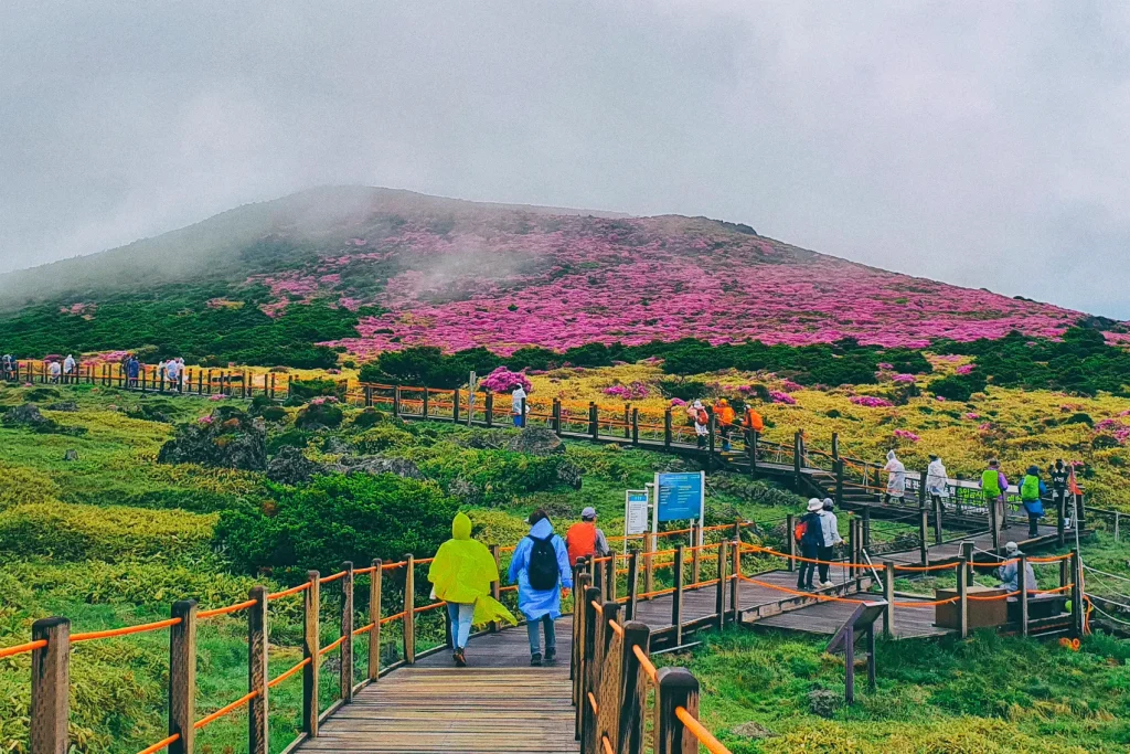
The Oreum-Centric Topography: One must view the island not as a flat plain but as a series of 360+ “sub-volcanoes.” Every village is defined by its proximity to a specific Oreum, which historically provided shelter from the wind and sites for spiritual worship.
Key Categories: Terrain, Culture, and Infrastructure
Jeju’s landscape is categorized by elevation and geological origin, each presenting different trade-offs for land use and travel.
| Category | Primary Feature | Strategic Importance | Trade-off/Risk |
| Highlands (Hallasan) | Alpine coniferous forest | Biodiversity; Water catchment | Extreme weather; restricted access |
| Middle Mountain (Jungsangan) | Oreum clusters; Gotjawal forests | Traditional grazing; tourism | Rapid development vs. conservation |
| Coastal Shelf | Basalt cliffs; black sand | Haenyeo diving; urban centers | Coastal erosion; over-tourism |
| Lava Tube Systems | Subterranean caverns | UNESCO status; scientific data | Structural instability; environmental sensitivity |
| Free International City | Duty-free zones; airports | Economic engine; global reach | Dilution of local culture; traffic congestion |
Decision Logic for Travel and Investment
Decisions on Jeju are driven by the “North-South Divide.”
-
Northern Focus (Jeju-si): Best for logistics, administrative access, and proximity to the mainland via the main airport. It is higher-density and faster-paced.
-
Southern Focus (Seogwipo): Preferred for wellness, deep-sea diving, and mild winter climates. It is the center of the “slow-life” movement.
Detailed Real-World Scenarios
The “Gotjawal” Conservation Conflict
-
Constraint: These areas are primary sites for groundwater recharge.
-
Decision Point: A developer proposes a golf course on private Gotjawal land.
-
Failure Mode: If approved, the local water table may drop or become contaminated.
-
Second-Order Effect: Loss of rare epiphytes and a decrease in the island’s natural carbon sequestration capacity.
The Dying Haenyeo Tradition
-
Constraint: Young generations prefer urban, indoor labor.
-
Decision Point: Government subsidies provide health insurance and equipment to new “migrant” divers from the mainland.
-
Failure Mode: The “intangible” communal knowledge of the sea cannot be easily subsidized or taught in a classroom.
-
Result: A shift from a living culture to a “museumified” performance for tourists.
Planning, Cost, and Resource Dynamics
| Resource/Service | Cost Range (USD) | Nuance |
| Car Rental (EV) | $40 – $120 / day | EV infrastructure is excellent; ICE vehicles are discouraged via tax. |
| Guesthouse (Minbak) | $30 – $70 / night | Deep immersion in local village life; minimal English. |
| Luxury Resort (Jungmun) | $300 – $800 / night | International standards; isolated from “real” Jeju culture. |
| Fresh Seafood Meal | $15 – $100 | Varies wildly based on whether it is “Haenyeo-caught” or imported. |
Tools, Strategies, and Support Systems
blog.onedaykorea.com
To engage with the island at an authority level, the following support systems are mandatory:
-
Naver/Kakao Maps: Google Maps is functionally broken in Korea due to national security laws regarding spatial data.
-
Jeju Olle Trail System: A 27-course trekking network that provides the only comprehensive non-vehicular access to the island’s perimeter.
-
T-Money/Local Transport Card: Mandatory for the efficient bus system, which was overhauled in 2017 to provide island-wide 40-minute frequency.
-
SAIS (Sea Awareness Information System): Critical for safety when exploring coastal rocks or lava tubes.
-
UNESCO Global Geopark Network: Provides educational frameworks and guided “Geo-trails” that explain the island’s formation.
Risk Landscape and Failure Modes
Exploring or operating in Jeju involves specific compounding risks:
-
Taxonomy of Natural Hazards:
-
Typhoons: Peak risk from August to September; can shut down all air and sea traffic for 48+ hours.
-
Black Ice: Occurs on the “1100 Road” crossing Hallasan, catching many rental-car drivers by surprise.
-
-
Systemic Failure Modes:
-
Water Scarcity: Over-extraction for golf courses and resorts threatens the “Porous Basin” model.
-
Waste Management: As an island, Jeju has a hard limit on landfill space.
-
Governance, Maintenance, and Long-Term Adaptation
Jeju’s governance is a “living lab” for Korean policy. The Jeju Special Act allows for rapid adaptation of laws to suit environmental or economic needs.
Maintenance and Review Cycles:
-
Carbon-Free Island (CFI) 2030: A goal to replace all vehicles with EVs and 100% of energy with renewables.
-
UNESCO Five-Year Review: Arigorousd audit of the island’s preservation efforts to maintain World Heritage status.
Measurement, Tracking, and Evaluation
Assessing the island’s “health” involves more than GDP.
-
Leading Indicators: The rate of new Haenyeo enrollments; EV charging station density; groundwater level at the 1100m altitude.
-
Lagging Indicators: Total tonnage of marine waste; annual visitor spend per capita; population growth in the Jungsangan (Middle Mountain) region.
-
Documentation Examples:
-
Geopark Revalidation Reports: Technical audits of site integrity.
-
Jeju Olle “Passport” Stamps: Qualitative data on pedestrian movement patterns.
-
Environment Support Fee (Proposed): A tracking mechanism for the “Tourist Tax” aimed at environmental restoration.
-
Common Misconceptions and Oversimplifications
-
“Jeju is a Tropical Island”: It is temperate-to-subtropical. Winters can be freezing, and snow is common on Hallasan.
-
“The Haenyeo are a Performance”: They are licensed fishers who maintain strict seasonal quotas and ecological management of the seabed.
-
“Jeju is Just for Honeymooners”: While historically true, the current demographic is “Digital Nomads” and hikers seeking the Olle Trail.
-
“Public Transport is Non-Existent”: The 2017 reform made Jeju’s bus network one of the most efficient rural systems in Asia.
-
“Black Pork is Only Found in Jeju”: While the breed is local, the “Jeju Black Pork” brand is heavily regulated to ensure quality.
-
“Mount Hallasan is an Easy Hike”: The weather changes in minutes; hikers are often turned back at the 1,500m mark due to high winds.
Ethical and Practical Considerations
Practically, one must respect the “4.3 Peace Park” not just as a site of interest, but as the emotional anchor of the island’s residents. Understanding the quiet resilience of the local population is the key to unlocking the true “depth” of the island beyond the basalt cliffs.
Conclusion
Jeju Island, Korea, stands as a microcosm of South Korea’s larger struggle to balance breakneck technological progress with deep-seated traditional values and environmental survival. It is an island built on basalt and tragedy, yet it has repurposed its isolation into a competitive global advantage.
Whether analyzed through its volcanic architecture, its matrifocal social history, or its autonomous governance, Jeju defies the mainland’s pull. It requires a visitor and a researcher who is willing to adapt to its slower speeds, its volatile winds, and its subterranean mysteries. To know Jeju is to understand that the surface beauty of a UNESCO site is merely the crust of a much deeper, more complex, and persistently adaptive system.