dirganews.com – The topography of Madinah is a ledger of human history, where volcanic basalt plains and verdant palm groves intersect with the foundational narratives of Islamic civilization. To approach the city merely as a contemporary urban center is to overlook the intricate layering of antiquity that defines its periphery. The city, historically known as Yathrib, functioned as an essential agricultural and commercial oasis long before the 7th-century Hijra.
Analyzing the various landmarks requires a departure from the conventional sightseeing mindset. Instead, one must view these locations as nodes in a complex socio-political and spiritual network. Each site, from the high ridges of Mount Uhud to the wells of the central plains, represents a specific moment of transition: from tribal fragmentation to organized governance, and from localized conflict to regional influence. This evolution is not just a matter of faith but of urban survival, resource management, and strategic defensive planning.
The current landscape is undergoing a massive transformation, driven by large-scale preservation and development initiatives under the Saudi Vision 2030 framework. This necessitates a sophisticated understanding of how to engage with these locations. The challenge for the modern researcher or traveler lies in reconciling the preserved archaeological evidence with the rapid modernization of the surrounding infrastructure. This article serves as a definitive analysis of the environment, providing the necessary depth to navigate the cultural and historical gravity of the region.
Understanding “Historic Sites Around Madinah”
www.britishhajtravel.com
Engagement with the Historic Sites Around Madinah necessitates a multi-dimensional perspective that transcends simple geography. These sites are often oversimplified as static museum pieces, when in reality, they are active participants in the city’s ongoing narrative. A common misunderstanding involves viewing these locations as isolated entities. In truth, the significance of a site like the Trench (Khandaq) is inextricable from the volcanic topography that dictated its location. Without the natural protection of the eastern and western lava fields, the historical strategy of the city’s defense would have been fundamentally different.
The risk of oversimplification often leads to a “check-list” approach to visitation. This fails to account for the systemic connections between landmarks. For instance, the placement of the early mosques was often determined by pre-existing tribal settlements—the atams or fortresses of the various clans. By ignoring the tribal layout of ancient Yathrib, one loses the context of why certain mosques are positioned where they are today. A sophisticated understanding recognizes these sites as part of a logistical and social tapestry.
Furthermore, the tension between preservation and accessibility creates a dynamic environment. Some sites are fully integrated into the modern city grid, while others remain on the rugged outskirts. Navigating this requires a grasp of the city’s master plan. The historical gravity of Madinah is not found in a single monument but in the relationship between the central sanctuary and the radiating historical nodes that protected and sustained it throughout the centuries.
Deep Contextual Background: The Evolution of Yathrib
The history of the Madinah region is one of hydraulic engineering and defensive positioning. Long before the 7th century, the oasis was inhabited by communities that specialized in date palm cultivation. The city’s systemic evolution was guided by the Wadi Al-Aqiq and Wadi Eitman, which channeled rainwater from the surrounding mountains into the central basin. This abundance of water made Yathrib a strategic prize on the incense and trade routes connecting Yemen to the Levant.
As the city transitioned into the Islamic era, its “system” shifted from tribal competition to centralized administration. This change is etched into the landscape. The construction of mosques and public spaces began to supersede the private fortresses of the local clans. This era also saw the formalization of the Haram (sanctuary) boundaries, a conceptual and legal framework that influenced urban growth for over a thousand years. The environmental systemic evolution from a series of disjointed fortified hamlets to a unified, sprawling metropolis is the primary context for understanding every ruin and restored structure in the region.
Conceptual Frameworks and Mental Models
To analyze the historical landscape effectively, one can apply three primary mental models:
-
The Defensive Topography Model: This framework views the city as a fortress. The lava fields (Harrah Rahat and Harrah Al-Wabarah) act as impenetrable walls, while the mountain passes act as gates. Historical events are understood through the lens of terrain advantages.
-
The Hydraulic Settlement Model: This model prioritizes the location of wells (bi’r) and wadis. The vitality and historical importance of a site are measured by its access to the aquifer. Many historic mosques were established at the sites of tribal wells, signifying the marriage of spiritual life and survival resources.
-
The Tribal-Territorial Mapping Model: This involves overlaying modern maps with the historical territories of the Aws, Khazraj, and other pre-Islamic clans. This explains the “clustering” of sites. Understanding that certain locations were neutral ground versus tribal heartlands provides depth to the historical negotiations that took place there.
Key Categories of Historical Landmarks
The landmarks can be organized into categories that highlight their functional and historical roles.
| Category | Primary Function | Notable Examples | Trade-off for Visitors |
| Defensive Sites | Military strategy & protection | Mount Uhud, The Trench (Seven Mosques) | Often rugged terrain; requires significant walking. |
| Early Foundational Mosques | Community & religious gathering | Masjid Quba, Masjid Qiblatayn | High foot traffic; modern renovations can obscure ancient ruins. |
| Hydraulic Heritage | Sustenance & agriculture | Bi’r Uthman, Bi’r Ghars | Limited access due to private ownership or preservation status. |
| Tribal Fortresses (Atams) | Residential security | Ruins in the Quba and Awali districts | Often in states of decay; requires historical maps to identify. |
| Commemorative Sites | Burial and remembrance | Jannat al-Baqi, Martyrs of Uhud | Highly sensitive areas; strict protocols and timing for access. |
Detailed Real-World Scenarios and Access Logic
Navigating the Uhud Battlefield
The Uhud site is more than a mountain; it is a complex battlefield spanning several kilometers.
-
Constraints: High temperatures and massive crowds during peak hours.
-
Decision Point: Whether to stay at the base (Archer’s Hill) or hike the accessible lower ridges of the mountain.
-
Failure Mode: Viewing the site only from the bus window, which obscures the tactical elevation that determined the outcome of the battle.
-
Second-Order Effect: Engaging with the terrain provides a visceral understanding of the strategic bottleneck that the valley represents.
Identifying the Seven Mosques at the Trench
The site of the Battle of the Trench is now marked by a series of small mosques.
-
Constraints: The original trench no longer exists; it was filled as the city expanded.
-
Decision Point: Focusing on the architecture of the modern mosques versus the geological shelf they are built upon.
-
Failure Mode: Misunderstanding the mosques as contemporary with the battle; they are Ottoman-era and later commemorations.
-
Logic: The mosques mark the command posts of the various tribal leaders during the siege.
Planning, Cost, and Resource Dynamics
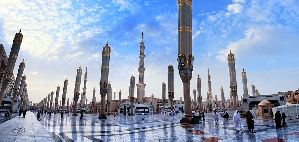
ik.imagekit.io
The cost of exploring the Historic Sites Around Madinah is rarely financial in the direct sense, as most sites are free to access. The primary variables are time, mobility, and heat management.
| Variable | Low-Impact Engagement | Deep-Research Engagement |
| Time Investment | 4–6 hours (Standard tour) | 3–5 days (Independent exploration) |
| Transport | Hop-on-hop-off buses ($20) | Private driver/walking (Varied) |
| Environmental Cost | Moderate (A/C vehicles) | High (Exposure to sun and volcanic terrain) |
| Intellectual Prep | Basic pamphlet | Detailed topographic and historical maps |
Opportunity cost is a major factor. Spending three hours in a queue at a major mosque may mean losing the opportunity to see three smaller, uncrowded archaeological sites in the southern oasis.
Tools, Strategies, and Support Systems
Successful engagement requires a specific toolkit:
-
Topographic Mapping Apps: To understand the elevation changes at Uhud or Mount Sela.
-
Hydrological Maps: Essential for locating the “lost” wells of Madinah.
-
The Early Morning Strategy: Avoiding the 10:00 AM – 4:00 PM heat window is the difference between a productive day and physical exhaustion.
-
Local Knowledge Networks: Engaging with researchers at the Al-Madinah Heritage Center for the most current excavation updates.
-
Shaded Logistics: Identifying the green corridor (the palm groves) for walking between Quba and the central area.
Risk Landscape and Failure Modes
The primary risks involved in exploring the periphery of the city are not security-related but are knowledge-based or environmental.
-
Environmental Compounding: High heat leads to poor decision-making, such as trying to climb a ridge without sufficient water.
-
Historical Displacement: Many sites have been relocated or renamed over the centuries. Relying on an old guidebook can lead to a site that no longer exists or has been closed for urban development.
-
Contextual Blindness: Visiting a site without understanding its pre-Islamic tribal context leads to a superficial experience where all mosques look the same.
-
The Construction Loop: With current development, many areas are under active construction. A failure to check live urban updates can result in reaching a site that is completely behind hoardings.
Governance, Maintenance, and Long-Term Adaptation
The Maintenance Checklist for Visitors:
-
Monitor: Check the Nusuk app or local government portals for site-specific closures.
-
Review: Understand the Ziyarah protocols—certain sites have different visiting hours for men and women.
-
Adjust: If a primary site is closed for renovation, have a secondary tier list (e.g., the Wells of the Awali district) ready to pivot.
Measurement, Tracking, and Evaluation
How does one measure a successful historical engagement?
-
Leading Indicators: Having a mapped-out itinerary that accounts for sun position and the ability to cite the tribal connection to at least three sites.
-
Lagging Indicators: A cohesive understanding of the city’s defensive perimeter and the ability to identify Ottoman vs. Modern vs. Abbasid architectural influences.
-
Documentation: Keeping a log of GPS pins for smaller, unrecorded ruins found in the palm groves—this contributes to the citizen archaeology of the region.
Common Misconceptions and Oversimplifications
-
Myth: The Seven Mosques were used by the Prophet simultaneously.
-
Correction: These were individual command posts for different companions, formalized as mosques centuries later.
-
-
Myth: All historic wells are safe to drink from.
-
Correction: Most are preserved for irrigation or historical value; the water is often non-potable without modern filtration.
-
-
Myth: You can see all the major sites in one day.
-
Correction: You can drive by them, but you cannot understand them. The heat and scale of the city require a multi-day approach.
-
-
Myth: Historic sites are all in the Central Area.
-
Correction: Some of the most significant defensive and agricultural sites are 10–15 km away from the Masjid An-Nabawi.
-
Ethical and Contextual Considerations
Preserving the sanctity of the region while encouraging tourism is a delicate balance. Visitors should be aware that many of these sites are active places of worship or are located in sensitive residential areas. The ethical approach involves:
-
Discretion: Avoiding intrusive photography in residential palm groves.
-
Environmental Stewardship: The volcanic harrah are fragile ecosystems; avoiding off-track driving is essential.
-
Intellectual Honesty: Acknowledging that many structures are reconstructions or marks of where history happened, rather than the original 7th-century wood and clay.
Conclusion
The Historic Sites Around Madinah offer a profound opportunity to witness the mechanics of history. The city is not a flat canvas but a vertical stack of civilizations, each responding to the same volcanic soil and the same scarce water. To explore these sites is to engage in a process of decoding the landscape.
Success in this endeavor is not found in the number of photos taken, but in the clarity of the mental map one builds. It is the ability to stand at the base of Mount Sela and look toward the plain of the Trench, seeing not a modern road, but the tactical logic of a people fighting for survival. This synthesis of geography, history, and strategic analysis is what transforms a simple visit into a definitive exploration of one of the world’s most significant cultural landscapes. The city remains adaptive, and the researcher must remain equally flexible, recognizing that as Madinah grows, its history is not being buried, but rather re-contextualized for a new era.