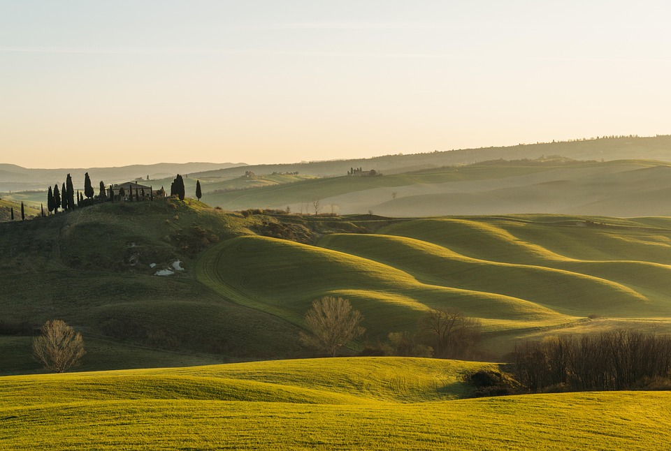
dirganews.com – The undulating terrain of central Italy represents more than a collection of geographical features. It is a palimpsest of human history. Neolithic settlement patterns, Etruscan urban planning, Roman engineering, and Medieval organization have left indelible marks on the topography. Observing this territory reveals the evolution of the Mediterranean agrarian model. Human habitation has negotiated environmental constraints here for millennia.
The region’s aesthetic reputation often obscures its systemic complexity. Iconic images of cypress-lined ridges and gold-hued plains persist. However, soil chemistry, micro-climate variability, and long-standing hydrological management truly dictate the landscape’s reality. Those viewing the area as a static, romanticized backdrop miss the intense labor required for its maintenance. This cultural landscape is not an accident of nature. It is the product of deliberate, inherited stewardship.
Engaging with this territory means discussing the sustainability of human systems within a constrained ecological framework. These upland zones face challenges ranging from demographic shifts to unstable viticultural patterns. Consequently, we need a rigorous, non-linear approach to analysis. This investigation moves past superficial narratives. It provides a definitive reference for those seeking to understand the structural realities, historical depth, and evolving dynamics of this human-wrought environment.
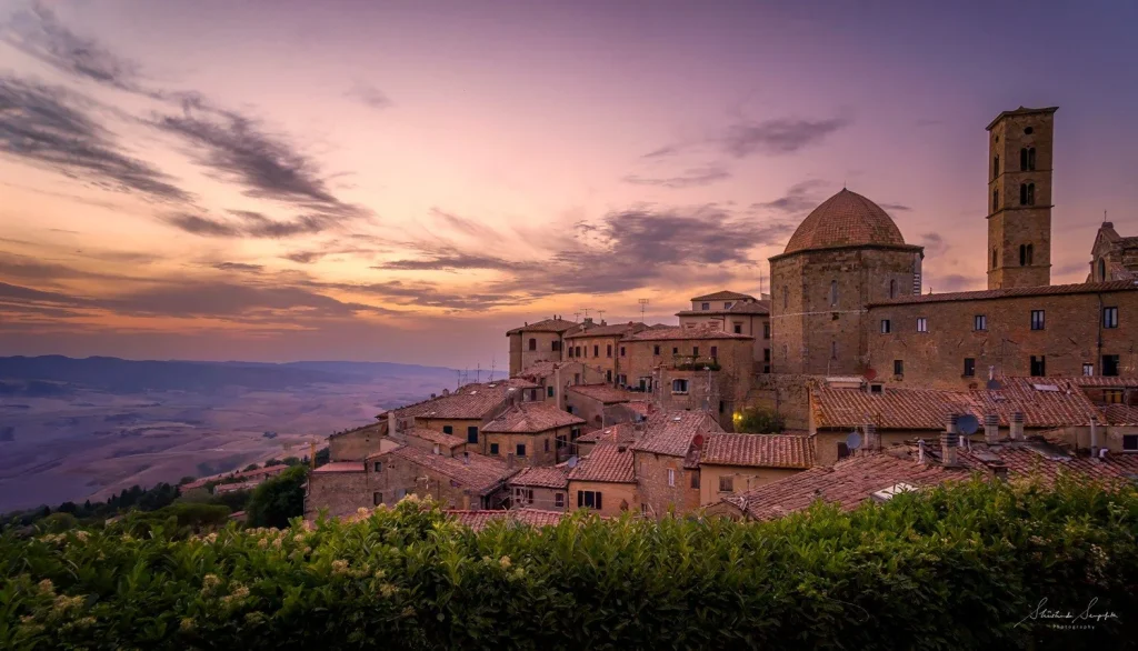
Understanding “Tuscany Hills.”
cdn.pixabay.com
“Tuscany Hills” is a reductive shorthand for a diverse and complex geological province. This categorization often suggests a homogeneous, rolling landscape. In reality, the region comprises a mosaic of discrete geological zones. These range from the clay slopes of the southern Crete Senesi to northern volcanic outcroppings and interior limestone ridges.
The primary danger in this oversimplification is failing to recognize divergent local pressures. A village on a sandstone ridge faces logistical challenges different from a farm in saturated, high-clay basins. Misunderstandings arise when stakeholders apply top-down policies across these disparate zones. Such policies often ignore specific ecological limits. This leads to development models that are aesthetically jarring and structurally untenable. They ignore the hydrological realities that have governed human interaction with this landscape for centuries.
Deep Contextual Background
Pliocene-era seas once covered this landscape, leaving behind deep deposits of marl and clay. These materials were challenging to cultivate due to their plasticity and erosion susceptibility. Yet, they provided the soil profiles necessary for sophisticated agrarian systems. Early inhabitants, particularly the Etruscans, modified the landscape through rudimentary hydrological management. They recognized that water control was the central prerequisite for permanent agricultural success.
This was not a passive arrangement. It was a highly regulated integration of forestry, cereal production, and viticulture that ensured self-sufficiency. Modern perceptions often mirror a fossilized image of this feudal system. However, the twentieth-century transition to mechanized agriculture disrupted this balance. It necessitated large-scale land consolidation and led to the abandonment of smaller, ecologically fragile plots that were once vital for landscape maintenance.
Conceptual Frameworks and Mental Models
-
The Agrarian-Ecological Feedback Loop: This model tracks the relationship between intensive agriculture and soil degradation. It illustrates how pushing for higher yields in marginal uplands compromises the watershed’s long-term hydrological stability.
-
The Settlement-Topography Heuristic: This framework evaluates village placement by prioritizing defensive utility, solar orientation, and access to subterranean water. It explains why certain sites have persisted for millennia while others were abandoned.
-
The Landscape Connectivity Index: This index measures how agricultural fragmentation impacts local fauna mobility and native forest health. It emphasizes the importance of non-productive habitat for ecological resilience.
-
The Economic Fragility Threshold: This calculation identifies the minimum human population density required to maintain the physical infrastructure—such as terracing, walls, and drainage channels of hillside environments.
Key Categories and Operational Variations
The variations in land management throughout the region reflect historical choices and contemporary economic pressures.
| Category | Primary Focus | Ecological Sensitivity | Economic Viability |
| High-Density Viticulture | Market Value | Low (High Input) | High |
| Traditional Polyculture | Self-Sufficiency/Heritage | High | Low |
| Managed Forest/Shrubland | Biodiversity/Water Management | High | Marginal |
| Extensive Grazing | Soil Health | Moderate | Low |
| Fragmented Hobbyist Plots | Amenity Value | Low | High |
Decision logic in these scenarios requires a reconciliation of immediate profitability with the inherent cost of maintaining the landscape. High-density viticulture, while economically dominant, often externalizes costs related to erosion and biodiversity loss, whereas polyculture approaches, while ecologically restorative, often struggle to survive without some form of external economic support.
Real-World Scenarios and Decision Logic
Consider the “Drainage Maintenance Crisis.” A traditional slope management system relies on a network of small, manually cleared trenches to prevent clay-rich slopes from liquefying during winter rainfall. The decision logic for local authorities is to either subsidize the labor-intensive upkeep recognizing its role as public infrastructure or face the long-term cost of large-scale slope failure and the loss of viable agricultural land.
In another scenario, “The Tourism-Land Use Conflict,” a developer seeks to convert a working agricultural estate into a luxury resort. While the resort offers short-term economic gains, the conversion results in the loss of permanent rural employment and the potential degradation of the site’s productive capacity. The logic of sustainable development suggests that only models integrating tourism with continued agricultural production can ensure the site’s long-term economic and aesthetic viability.
Planning, Cost, and Resource Dynamics
The management of upland zones is inherently expensive due to the lack of economies of scale.
-
Direct Costs: Infrastructure upkeep, including the repair of dry-stone walls and the periodic clearance of hydrological channels, remains the primary expenditure.
-
Opportunity Costs: Land that could be highly productive under industrial agriculture is often restricted by heritage designations, limiting the return on investment.
-
Variability: Costs are disproportionately influenced by the physical slope. Maintaining a hectare on a 25-degree gradient is exponentially more expensive than maintaining a hectare of lowland plain.
| Planning Component | Cost Range (USD/Ha/Year) | Primary Driver |
| High-Slope Maintenance | $1,500 – $4,000 | Manual labor intensity |
| Standard Viticulture | $300 – $800 | Mechanized inputs |
| Forest/Shrub Management | $50 – $200 | Regulatory compliance |
Tools, Strategies, and Support Systems
-
Lidar Topographical Mapping: A critical tool for identifying historical drainage networks that have been obscured by decades of landscape change.
-
Community Land Trusts: A structural strategy for pooling the resources of smaller landowners to manage larger, contiguous sections of the watershed.
-
Heritage-Linked Agricultural Incentives: Policy-driven support systems that recognize the ecological services provided by traditional, low-intensity farming methods.
-
Local Knowledge Archives: Preserving the oral and written records of ancestral land management techniques, which are often better suited to the specific geological constraints of the region than modern imported practices.
Risk Landscape and Failure Modes
The failure mode of “Landscape Atrophy” occurs when the population density drops below a critical threshold, leading to the irreversible collapse of the drainage and terrace infrastructure. Another risk is “Chemical Exhaustion,” where reliance on synthetic inputs in high-value viticulture leads to soil compaction and the destruction of the natural soil biology, rendering the land less resilient to climate-induced hydrological variability. These risks are compounded by the threat of “amenity-driven gentrification,” where the land becomes a decorative object rather than a productive resource, hollowed out of the human activity required to maintain it.
Governance, Maintenance, and Long-Term Adaptation
Sustainability in this region is a governance challenge, not a purely technical one.
-
Monitoring Cycles: Management plans should prioritize the state of the hydrological infrastructure, with mandatory assessments occurring post-winter.
-
Adjustment Triggers: The decline in active agricultural use of specific sub-basins should trigger immediate municipal review to identify the cause of abandonment and potential mitigation strategies.
-
Layered Checklist: A long-term management framework must include hydrological integrity, soil organic matter levels, and the retention of a minimum viable number of permanent agricultural residents.
Measurement, Tracking, and Evaluation
-
Leading Indicators: Changes in the maintenance frequency of drainage systems, the retention rate of younger generations in the rural workforce, and the health of native vegetative cover on marginal slopes.
-
Lagging Indicators: Total soil erosion rates, species diversity within the agricultural matrix, and the economic performance of traditional polyculture compared to monocropping.
-
Documentation: Regional land-use transition maps, agricultural input/output records, and oral histories of landscape management changes over a thirty-year horizon.
Common Misconceptions and Oversimplifications
-
Myth: “The landscape is entirely natural.”
Correction: It is a high-maintenance cultural artifact that requires constant human input to prevent degradation into scrubland or ravine erosion. -
Myth: “Tourism is the only way to save the hills.”
Correction: Over-reliance on tourism creates a hollow economy that is vulnerable to global shocks and fails to maintain the productive land base. -
Myth: “Mechanized agriculture is inherently efficient.”
Correction: In steep upland zones, mechanization often forces the removal of essential protective features like terracing and hedgerows, increasing long-term erosion risk.
Ethical, Practical, and Contextual Considerations
The Ethical Imperative: Beyond the Aesthetic
Ethically, the primary responsibility lies in resisting the commodification of the landscape as a static “scenery.” When visitors or investors treat the territory as a museum piece, they inadvertently undermine the living, breathing reality of the people whose labor maintains the environment. The ethical observer—and the responsible developer must recognize that the beauty of these hills is not an accidental byproduct; it is the manifestation of centuries of active drainage, soil conservation, and forest management. To support this region is to support the preservation of the agrarian community, rather than merely the preservation of the view. This involves moving beyond the “visitor” perspective and toward one of an informed participant who values local continuity over imported trends.
Practical Realities of Maintenance
Practically, the survival of the regional identity rests upon the physical integrity of the topography. The maintenance of dry-stone walls, the management of runoff in clay-rich soils, and the preservation of agricultural biodiversity are not luxury activities—they are essential infrastructure.
-
The Labor-Capital Mismatch: There is a persistent tension between the high cost of manual maintenance on steep slopes and the lower profit margins of traditional, ecologically sound farming methods. Practical sustainability requires new financial mechanisms, such as payments for “ecosystem services,” to bridge this gap.
-
Adaptation vs. Preservation: Practitioners must balance the need to preserve heritage structures with the need to implement modern, more efficient water management techniques. A rigid adherence to tradition can be as dangerous as unchecked modernization; the goal must be technically informed evolution.
Contextual Considerations and Systemic Resilience
Contextually, the region is highly susceptible to the dual pressures of climate change and demographic decline. Concurrently, the migration of the younger workforce toward urban cores leaves an aging population that cannot physically maintain the landscape’s defensive infrastructure.
-
Integrated Landscape Management: Strategies must be deployed at the watershed scale, not the property scale. Managing a single farm is insufficient if the neighbor upstream is allowing their drainage channels to silt up or their slopes to erode.
-
Cultural Continuity: Long-term resilience is impossible without the active participation of the local population. Policies that focus on “attracting” the demographic are often less effective than those that “empower” the existing community through sustainable enterprise, education, and infrastructure investment.
Ultimately, the contextual success of these regions depends on their ability to remain productive. A landscape that produces value, whether agricultural, ecological, or community-based, is a landscape that will be maintained. When productivity is lost, the landscape inevitably drifts toward degradation. Therefore, the most ethical and practical approach is to champion systems that allow for small-scale, high-quality production that is resilient to both market shocks and the changing climate, ensuring the region retains its vitality as a working, living environment rather than an empty, aesthetic shell.
Conclusion
The character of the region is defined by its resilience and its inherent fragility. This landscape, while appearing eternal, is a sensitive entity, requiring a sophisticated and iterative approach to management that honors its historical context while acknowledging the pressures of the modern era. By moving toward a model that values the functional integration of land-use, community stability, and hydrological awareness, it is possible to ensure that these hills continue to serve as both a productive human home and a symbol of harmonious land management. The path forward is not found in the romanticization of the past, but in the rigorous, patient, and informed stewardship of the landscape’s future. There is no simple resolution to the challenges of rural persistence, yet by applying a methodical and honest examination of the region’s systemic needs, a path toward long-term viability becomes visible.